Шрифт
Цвет
Графика
«Циничные карты» культурный шок в бесплатной онлайн игре!
Изображение точки

Чтобы увидеть режим дополненной реальности в действии:

1. Установите приложение ARTEFACT для iOS или Android;

2. Найдите выставку «Exhibition of Lenin House-Museum»

3. Нажмите на кнопку «Распознать» и наведите камеру на экспонат;

Скрыть точки интересаПоказать точки интереса
Показать в высоком качестве

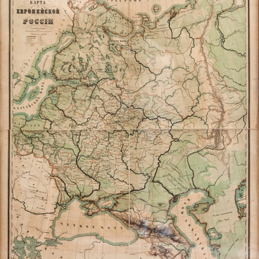
Map of Europe

Время создания
second half of the 19th century
Место создания
St. Petersburg, Russia
Размер
81x99 cm
Техника
typographic printing
Коллекция
0
Открыть в приложении
#1
Alexey Ilyin’s Cartographic Establishment
Map of Europe
 
#2
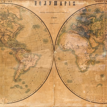
The Ulyanovs' favorite place for family evenings was the spacious dining room. The family gathered here to play chess, read books, and talk. There were two geographic maps on the wall in this room.

Lenin’s elder sister Anna Ulyanova-Elizarova recalled,
#8
The furnishings were very simple, which is generally common among the middle class, the new items were bought on occasion <…> there were no portraits and paintings on the walls, the room had a puritanical atmosphere <…> there were geographic maps — my father bought them for the children.
#9
Geographic maps on the walls, according to Anna, were the family necessities, like a grand piano and books in the bookcases and on the shelves.

One of the maps on display is called ‘Europe’. This map is physical and partly general geographic by the content — it shows the topography, the appearance of the territory and water areas. It covers the territory of Outer Europe, a swath of North Africa, and the European part of the Russian Empire. The map is an overview one with a small scale of 100 versts to inch, or 42 kilometers to centimeter.

These maps were used for educational and introductory purposes and were commonly acquired for schools, gymnasiums, colleges, and universities in the Russian Empire.

The map shows Europe and the European part of the Russian Empire with physical and geographic features such as rivers, lakes, seas, oceans, bays, and straits. It shows the coastline marked with a bold light-blue stripe. Mountain ranges, plains, and lowlands are colored in layers by height classes. This technique is called hypsographic coloring. The higher points on the map are marked in brown, the map compilers also used beige, dark and light green according to the terrain level.

The map was produced in the second half of the 19th century at the Cartographic establishment of Alexei Ilyin in St. Petersburg. It was founded in 1859 by General Staff officers Alexey Ilyin and Vladimir Poltoratsky. By 1882, the establishment produced up to six million reprints, which were about 90% of the Russian Empire’s civilian cartographic output.
#7
читать дальшескрыть
00:00
00:00
1x

Map of Europe

Время создания
second half of the 19th century
Место создания
St. Petersburg, Russia
Размер
81x99 cm
Техника
typographic printing
Коллекция
0
Наведите камеру вашего смартфона, чтобы открыть в приложении
Поделиться
ВконтактеОдноклассникиTelegram
Разместить на сайте
Скопировать ссылкуСкопировано
Скопировать код
Открыть в приложении
Чтобы увидеть режим дополненной реальности в действии:
  1. Установите приложение ARTEFACT для 
  2. iOS или Android;
  3. Найдите выставку «Картины в деталях»
  4. Нажмите на кнопку «Начать просмотр» и наведите камеру на картину;
  5. Перелистывайте картины на компьютере и следите за происходящим на экране смартфона.
 
«Циничные карты» культурный шок в бесплатной онлайн игре!
Мы используем Cookies
Во время посещения данного сайта, Минкультуры России может использовать общеотраслевую технологию, называемую cookie. Файлы cookie представляют собой небольшие фрагменты данных, которые временно сохраняются на вашем компьютере или мобильном устройстве, и обеспечивают более эффективную работу сайта. Продолжая просматривать данный сайт, Вы соглашаетесь с использованием файлов cookie и принимаете условия.
Подробнее об использованииСкрыть
Содержимое доступно только на русском

X

Нашли опечатку?...

%title%%type%