The layout of the historical part of the modern Petrozavodsk has been preserved since the reign of Empress Catherine II, who granted a general layout to the city in order to build the Petrozavodsk settlement. This settlement was a part of the Novgorod Viceroyalty and became the city of Petrozavodsk on March 21, 1777, when Catherine II issued a special decree on renaming.
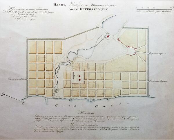
In 1778, the Empress ordered a new city plan to be drawn up. On December 15 of the same year, she approved it and ordered all developers to adhere to the plan. Today it is displayed in the permanent exhibition of the National Museum of the Republic of Karelia.
From the first years of her reign, Catherine II created the “Commission for the Construction of Cities”, designed to carry out urban planning reforms and to bring the development of Russian cities to a single standard. The work of this Commission resulted in plans for more than 400 cities, including Karelian ones: Olonets, Povenets, and Vytegra. During the reform, random development gave way to an “exemplary” one: streets were made wide and straight, squares were laid out, entire blocks were erected.
The city plans were created based on exemplary projects. In the new plans, the streets were divided by their importance into entrance streets, or main streets, highways, and secondary streets. In Petrozavodsk, the main street was Peterburgsky Tract, now it is Engels Avenue. The city borders were marked by ramparts. The Petrozavodsk plan demonstrates the features of the classic three-pointed layout, which was first used in Russia in 1763 during the creation of the Tver plan. Kruglaya (Tsirkulnaya) Square was the center of the city, from which three rays — streets — went in different directions. The main streets always ended with squares, on which, following the example of ancient Russian cities, there was a cathedral, a palace, rows of shops, and the so-called “public places” — state offices.
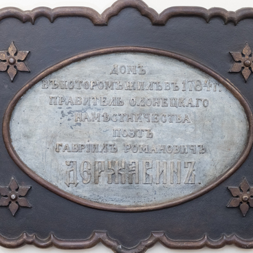
In 1782, the status of the main city of the region was transferred from Olonets to Petrozavodsk, and in 1784, by the decree of Catherine II, the Olonets Viceroyalty was made a governorate. Therefore, Petrozavodsk was excluded from the cities of the Novgorod Viceroyalty. Gavriil Derzhavin was appointed the first governor of the new entity.
In 1778, the Empress ordered a new city plan to be drawn up. On December 15 of the same year, she approved it and ordered all developers to adhere to the plan. Today it is displayed in the permanent exhibition of the National Museum of the Republic of Karelia.
From the first years of her reign, Catherine II created the “Commission for the Construction of Cities”, designed to carry out urban planning reforms and to bring the development of Russian cities to a single standard. The work of this Commission resulted in plans for more than 400 cities, including Karelian ones: Olonets, Povenets, and Vytegra. During the reform, random development gave way to an “exemplary” one: streets were made wide and straight, squares were laid out, entire blocks were erected.
The city plans were created based on exemplary projects. In the new plans, the streets were divided by their importance into entrance streets, or main streets, highways, and secondary streets. In Petrozavodsk, the main street was Peterburgsky Tract, now it is Engels Avenue. The city borders were marked by ramparts. The Petrozavodsk plan demonstrates the features of the classic three-pointed layout, which was first used in Russia in 1763 during the creation of the Tver plan. Kruglaya (Tsirkulnaya) Square was the center of the city, from which three rays — streets — went in different directions. The main streets always ended with squares, on which, following the example of ancient Russian cities, there was a cathedral, a palace, rows of shops, and the so-called “public places” — state offices.
In 1782, the status of the main city of the region was transferred from Olonets to Petrozavodsk, and in 1784, by the decree of Catherine II, the Olonets Viceroyalty was made a governorate. Therefore, Petrozavodsk was excluded from the cities of the Novgorod Viceroyalty. Gavriil Derzhavin was appointed the first governor of the new entity.